import matplotlib.pyplot as plt
import cartopy.crs as ccrs
import cartopy.feature as cfeature
from matplotlib.offsetbox import AnchoredText
def main():
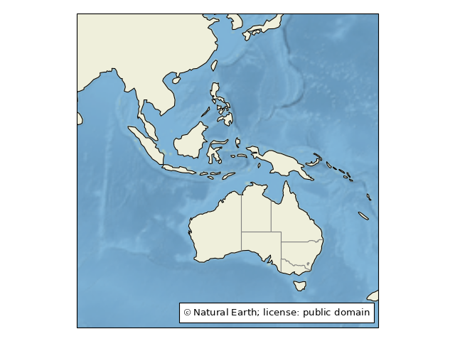
ax = plt.axes(projection=ccrs.PlateCarree())
ax.set_extent([80, 170, -45, 30])
# Put a background image on for nice sea rendering.
ax.stock_img()
# Create a feature for States/Admin 1 regions at 1:50m from Natural Earth
states_provinces = cfeature.NaturalEarthFeature(
category='cultural',
name='admin_1_states_provinces_lines',
scale='50m',
facecolor='none')
SOURCE = 'Natural Earth'
LICENSE = 'public domain'
ax.add_feature(cfeature.LAND)
ax.add_feature(cfeature.COASTLINE)
ax.add_feature(states_provinces, edgecolor='gray')
# Add a text annotation for the license information to the
# the bottom right corner.
text = AnchoredText(r'$\mathcircled{{c}}$ {}; license: {}'
''.format(SOURCE, LICENSE),
loc=4, prop={'size': 12}, frameon=True)
ax.add_artist(text)
plt.show()
if __name__ == '__main__':
main()