global_map example
import matplotlib.pyplot as plt
import cartopy.crs as ccrs
def main():
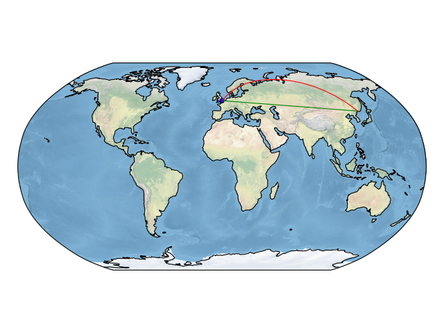
ax = plt.axes(projection=ccrs.Robinson())
# make the map global rather than have it zoom in to
# the extents of any plotted data
ax.set_global()
ax.stock_img()
ax.coastlines()
plt.plot(-0.08, 51.53, 'o', transform=ccrs.PlateCarree())
plt.plot([-0.08, 132], [51.53, 43.17], transform=ccrs.PlateCarree())
plt.plot([-0.08, 132], [51.53, 43.17], transform=ccrs.Geodetic())
plt.show()
if __name__ == '__main__':
main()