Note
Click here to download the full example code
Regridding vectors with quiver
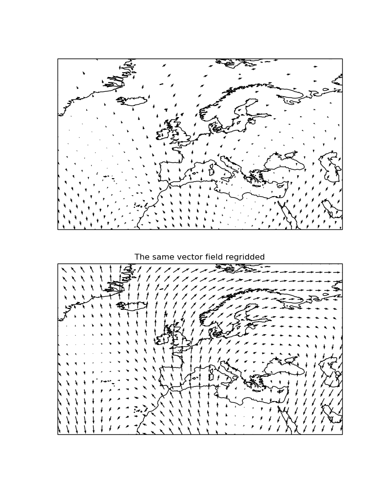
This example demonstrates the regridding functionality in quiver (there exists
equivalent functionality in cartopy.mpl.geoaxes.GeoAxes.barbs()).
Regridding can be an effective way of visualising a vector field, particularly if the data is dense or warped.

import matplotlib.pyplot as plt
import numpy as np

import cartopy.crs as ccrs


def sample_data(shape=(20, 30)):
    """
    Return ``(x, y, u, v, crs)`` of some vector data
    computed mathematically. The returned CRS will be a North Polar
    Stereographic projection, meaning that the vectors will be unevenly
    spaced in a PlateCarree projection.

    """
    crs = ccrs.NorthPolarStereo()
    scale = 1e7
    x = np.linspace(-scale, scale, shape[1])
    y = np.linspace(-scale, scale, shape[0])

    x2d, y2d = np.meshgrid(x, y)
    u = 10 * np.cos(2 * x2d / scale + 3 * y2d / scale)
    v = 20 * np.cos(6 * x2d / scale)

    return x, y, u, v, crs


def main():
    fig = plt.figure(figsize=(8, 10))

    x, y, u, v, vector_crs = sample_data(shape=(50, 50))
    ax1 = fig.add_subplot(2, 1, 1, projection=ccrs.PlateCarree())
    ax1.coastlines('50m')
    ax1.set_extent([-45, 55, 20, 80], ccrs.PlateCarree())
    ax1.quiver(x, y, u, v, transform=vector_crs)

    ax2 = fig.add_subplot(2, 1, 2, projection=ccrs.PlateCarree())
    ax2.set_title('The same vector field regridded')
    ax2.coastlines('50m')
    ax2.set_extent([-45, 55, 20, 80], ccrs.PlateCarree())
    ax2.quiver(x, y, u, v, transform=vector_crs, regrid_shape=20)

    plt.show()


if __name__ == '__main__':
    main()
Total running time of the script: ( 0 minutes 0.120 seconds)
