
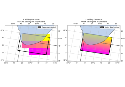
Scalar data#
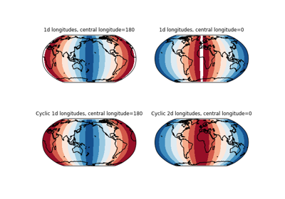
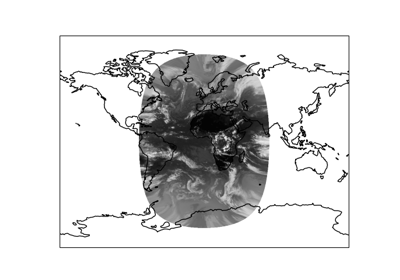
Adding a cyclic point to help with wrapping of global data
Adding a cyclic point to help with wrapping of global data
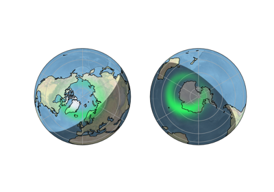
Plotting the Aurora Forecast from NOAA on Orthographic Polar Projection
Plotting the Aurora Forecast from NOAA on Orthographic Polar Projection
Reprojecting images from a Geostationary projection
Reprojecting images from a Geostationary projection