
Version 0.16 (February 21, 2018)#
Features#
We are very pleased to announce that Ryan May has been added to the cartopy core development team. Ryan (@dopplershift) brings a wealth of experience, and has already made significant contributions to the Matplotlib interface, extended projections, and helped modernise the development infrastructure.
The
Gnomonicprojection was brought up-to-date to include thecentral_longitudeargument. (PR #855)Ryan May improved the formulation of the boundary ellipse for the
Geostationaryprojection and added thesweep_angle_axiskeyword argument. (PR #890, PR #897)Elliott Sales de Andrade made a number of micro-optimisations to the Matplotlib interface, fixed a number of documentation issues with Python 3 and added Matplotlib 2.0 & 2.1 compatibility. (PR #886, PR #901, PR #780, PR #773, PR #977)
Tick padding was added to the gridliner.
cartopy.mpl.gridliner.Gridliner.xpaddingandypaddingrelate. (PR #783)Ryan May added the
with_scale()method to the NaturalEarthFeature class. For example, it is now possible to access higher resolution land features withcartopy.feature.LAND.with_scale('50m'). In addition to this,cartopy.feature.STATESwas added to easily access administrative area boundaries that were previously only accessible by manually constructingNaturalEarthFeatureinstances (as is done in the Feature Creation example). (PR #898)Daryl Herzmann and Robert Redl improved cartopy’s internal conversion between Shapely objects and Matplotlib Paths. (PR #885 & PR #1021)
Åsmund Steen Skjæveland fixed
cartopy.mpl.geoaxes.GeoAxes.tissot()to use the documented units of kilometres, where before it had been using metres. (PR #904)Andrew Dawson wrote a new tutorial for the user guide: Understanding the transform and projection keywords. (PR #914)
Daniel Kirkham and Daryl Herzmann made significant improvements to the stability of polygon transformation. The changes reduce the frequency of messages such as
Unidentified problem with geometry, linestring being re-addedandSelf-intersection at or near point <X> <Y>occurring. (PR #974 and PR #903)Chris Holdgraf and Corinne Bosley worked collaboratively to bring sphinx-gallery to the cartopy docs. (PR #969)
Ray Bell neatened up many of the examples to explicitly pass the coordinate system when calling
set_extent(). (PR #975)Ryan May changed the default zorder of LAND and OCEAN to -1, thus fixing an issue with LAND/OCEAN appearing above some data elements such as vectors. (PR #916)
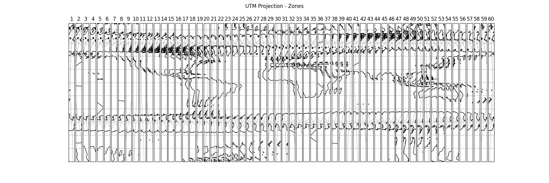
Kevin Donkers added the 60 UTM projections example to the gallery in PR #954:
Andrey Kiselev added support for reading shapes with a third (Z) dimension. (PR #958)
Corinne Bosley standardised the docstring format for improved readability and visual consistency. (PR #987)
Cartopy now no longer enables
shapely.speedups()at cartopy import time. (PR #990)Mahé Perrette and Ryan May collaborated to improve the
Stereographicprojection. (PR #929)